Facilities Available: Mobile Phone Reception
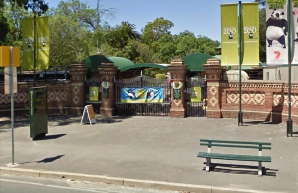
The Adelaide Zoo has over 1,800 animals and almost 300 species of exotic and native mammals, birds, reptiles and fish exhibited in 8 hectares of magnificent botanic surroundings. Entrance to the Adelaide Zoo Adelaide Zoo location map
 ,
, 
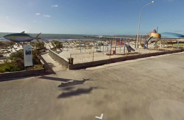
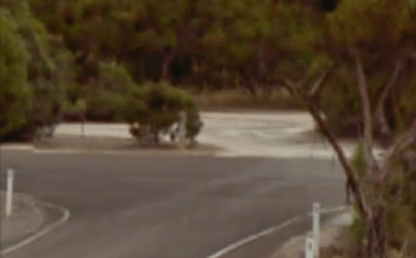
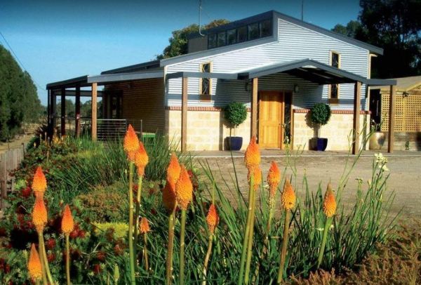
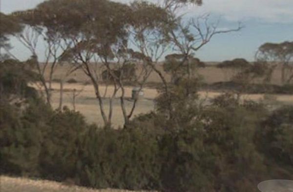
The Arno Bay Park Rest Area is next to a children's playground and a short stroll to the beach, and the town jetty. The Hotel Arno is within easy walking distance also. Entrance to the Arno Bay Park Rest Area Arno Bay Park Rest Area location map ...
,  ,
,  ,
,
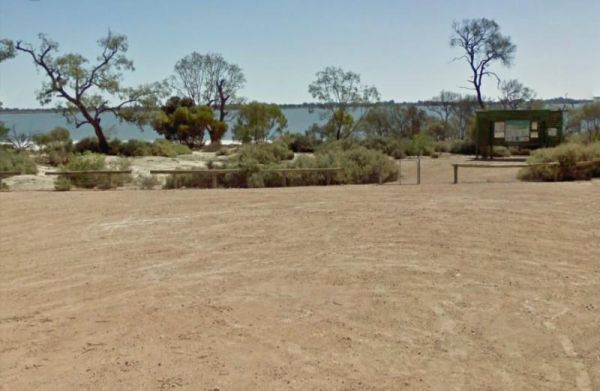
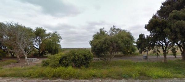
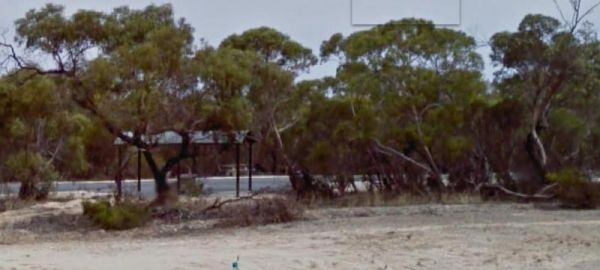
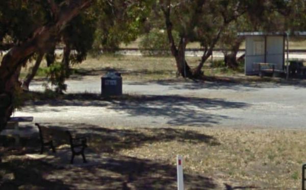
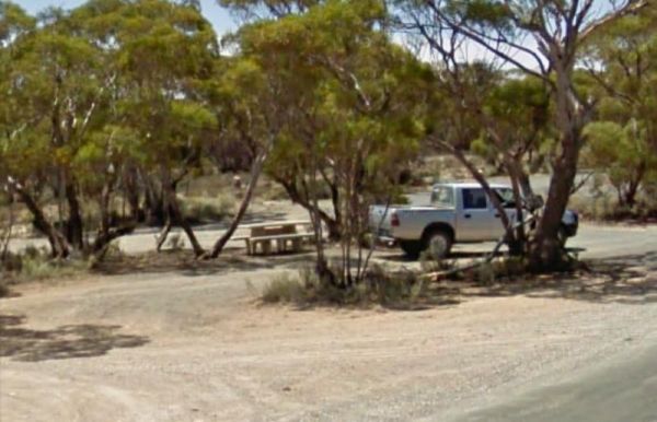
The Barmera Apex Park Rest Area is a gravel area within easy walking distance to the Lake Bonney. The lake is quite shallow here, so it's not a bad spot to have a splash with the kids. Entrance to the Barmera Apex Park Rest Area Barmera Apex Park Rest ...
,  ,
,  , , ,
, , , 
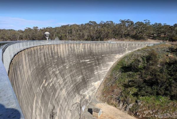
Barossa Reservoir Whispering Wall
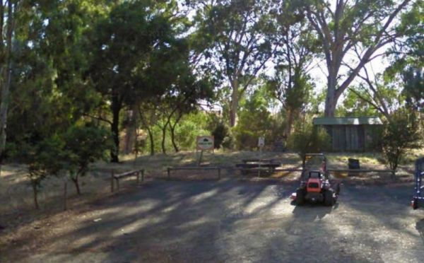
The Barossa Reservoir Whispering Wall is a large area that can handle all sized rigas, and this spot even has free WiFi in the car park. The Dam wall was built between 1899 and 1903 and it's almost a perfect acoustic wall, with sound travelling along its ...
, ,  ,
,  ,
, 
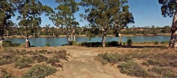
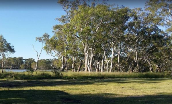
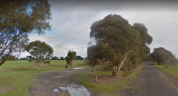
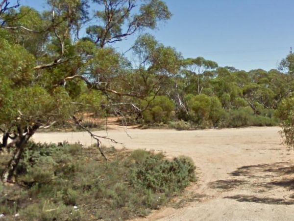
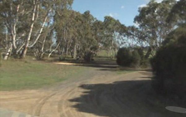
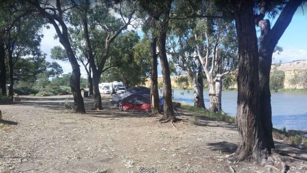
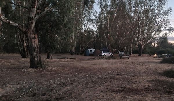
The Big Bend Camping Area is on the banks of the Murray River, there are plenty of camping spots to choose from, all with rivergums, and a waterfront view. Entrance to the Big Bend Camping Area Big Bend Camping Area location map

The Bool Lagoon Turnoff Rest Area is just a short distance off the Riddoch Highway. There are picnic tables, a bit of shade and an information wall and an undercover picnic table, and rubbish bins. Entrance to the Bool Lagoon Turnoff Rest Area Bool La ...
,
The Boston Bay Rest Area is a large gravel area with public toilets and aa undercover picnic tables overlooking the sea. The Lions Picnic Spot is next door. Entrance to the Boston Bay Rest Area Boston Bay Rest Area location map
, ,
The Bower Rest Area is located next to tennis courts and town hall. A public toilet is onsite and some tank water. Entrance to the Bower Rest Area Bower Rest Area location map
, , , ,
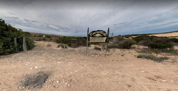
Carrow Wells Campground
The Carrow Wells Campground is a short distance from the North Coast Road, and is a gravel surface. There is an interesting sign explaining the history of the site and its link to the Aboriginal people who lived here. Entrance to the Carrow Wells Campgro ...
,
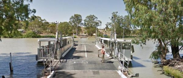
Caurnamont Reserve Rest Area
The Caurnamont Reserve Rest Area is next to the the Murray River, with Public Toilets and room to park your caravan. From here you can take the ferry across to Purnong Landing. Entrance to the Caurnamont Reserve Rest Area Caurnamont Reserve Rest Area ...
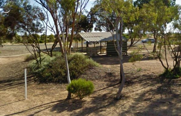
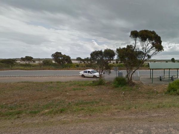
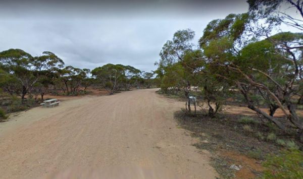
The Chandada Pioneer Park Runs alongside the Streaky Bay Highway, its a level area with Rubbish bins and a picnic table, and a few farming relics, but very limited shade. its OK for a break from driving. Entrance to the Chandada Pioneer Park Chandada ...
,
The Clay Wells Rest Area runs parallel to the Princes Highway, there is a picnic table and rubbish bins, some shady trees, with not a lot between you and the Princes Highway. Entrance to the Clay Wells Rest Area Clay Wells Rest Area location map
,
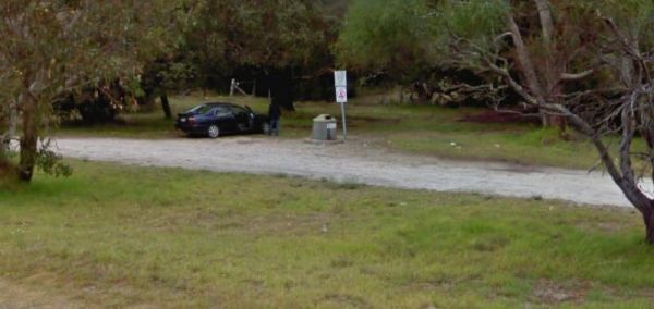
The Cockatoo Lake Reserve is a lovely bush camp with 1 flushing toilet and plenty of grassy areas to park your caravan or motorhome. There is plenty of wildlife and lots of noisy corellas roosting. Cockatoo Lake Reserve location map
, , , ,
The Cohen Rest Area has easy access for all sized rigs, there are some rubbish bins and lots of shady spots. If you stay overnight you will hear some traffic noise as truck pass by. Entrance to the Cohen Rest Area Cohen Rest Area location map
, ,
Coober Pedy Tourist Information Centre
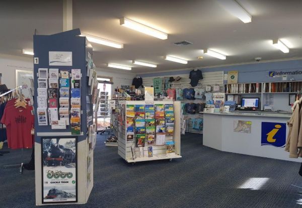
The Coober Pedy Tourist Information Centre is your port of call when you pop into Coober Pedy for the first time. There plenty to see and do in this remote Australian settlement.Opening Hours: Monday to Friday 9am to 5pm and weekends and public holidays 9 ...
Coomandook Park Rest Area
The Coomandook Park Rest Area has plenty of room to park all sized rigs. There are undercover picnic tables, Rubbish bins and a public toilet. You can also walk across the road to the Coomandook General store and stock up on a few items or fill your fuel ...
, ,
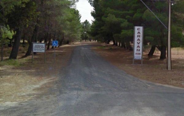
Entrance to the Coonalpyn Soldiers Memorial Caravan Park Coonalpyn Soldiers Memorial Caravan Park location map
, , ,  , , , ,
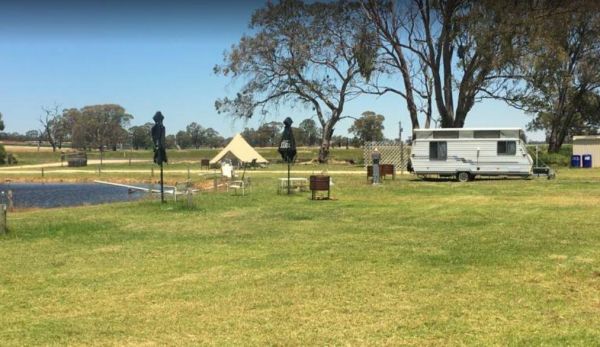
Coonawarra Bush Holiday Park
Entrance to the Coonawarra Bush Holiday Park Coonawarra Bush Holiday Park location map
, , , , , , ,
Coonawarra Rest Area
The Coonawarra Rest Area is just off the Riddoch Highway on a gravel road with plenty of room to park your caravan. There are rubbish bins and an undercover picnic table overlooking vineyards. Entrance to the Coonawarra Rest Area Coonawarra Rest Area ...
,
The Cowell Park Rest Area Entrance to the Cowell Park Rest Area Cowell Park Rest Area location map
, ,
The Culburra North Rest Area Entrance to the Culburra North Rest Area Culburra North Rest Area location map
,
The Drain M Rest Area is set back from the Princes Highway with a small row of trees for shade, and a rubbish bin. There's not much to do here apart from taking a break from driving. Entrance to the Drain M Rest Area Drain M Rest Area location map ...
,
The Dublin Lions Park Rest Area Entrance to the Dublin Lions Park Rest Area Dublin Lions Park Rest Area location map
, ,  , ,
, ,
The Dublin North Rest Area is in close proximity of the Princes Highway with an undercover picnic table, and a few rubbish bins. There is very limited shade here, but plenty of room to park your caravan. Entrance to the Dublin North Rest Area Dublin N ...
,
Eight Mile Corner Rest Area
The Eight Mile Corner Rest Area is set back a short distance from the Sturt Highway, with plenty of room to park. There is an undercover picnic table nad rubbish bin at your disposal here but not much else.There is a 20 hour stopover permitted at this res ...
,
Eyre's Water Hole Rest Area
The Eyre's Water Hole Rest Area Entrance to the Eyre's Water Hole Rest Area Eyre's Water Hole Rest Area location map
,
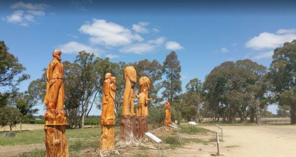
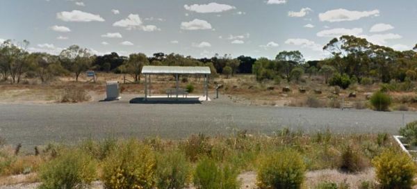
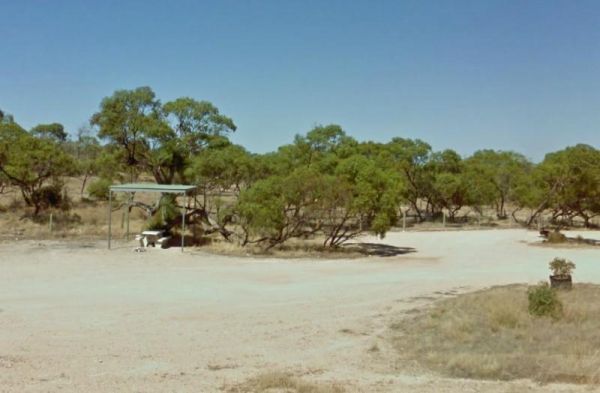
The Father Woods Park is just off the Riddoch Highway, featuring Chainsaw wood carvings and History of to a priest called Father Woods, who spent 10 years during the 1800's, in this local vicinity, and also carvings of Mary Mackillop another prominent per ...
,
Fitzgerald Bay Camping Areas
The Fitzgerald Bay Camping Areas are all in designated locations with nice views of the bay. There are no facilities so make sure you bring everything you need and take your rubbish with you when you leave. Fitzgerald Bay Camping Areas location map
,
The Forestry Information Stop is set back a short distance from the Riddoch Highway along the Bookers Lane and amongst some large trees that offer plenty of shade. Entrance to the Forestry Information Stop Forestry Information Stop location map
,
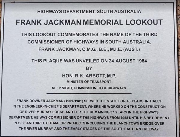
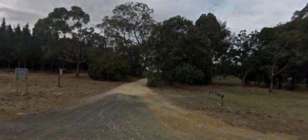
Frank Jackman Memorial Lookout is located on an asphalt circular drive, with a few trees, picnic tables and rubbish bins along its length. Entranced to the Frank Jackman Memorial Lookout Frank Jackman Memorial Lookout location map
,
Frank Potts Reserve
The Frank Potts Reserve has a public toilet and picnic tables and rubbish bins with plenty of shade to pick your campsite from. There is a small fee per night to stay here and your limited to a maximum of 72 hours, but well worth it. The local shop pub an ...
Freds Landing Rest Area
The Freds Landing Rest Area is nestled between the Murray River and the Princes Highway. There is plenty of room to park your caravan, there are not many shade trees to park under, but there is a public toilet, picnic tables, and rubbish bins, and those i ...

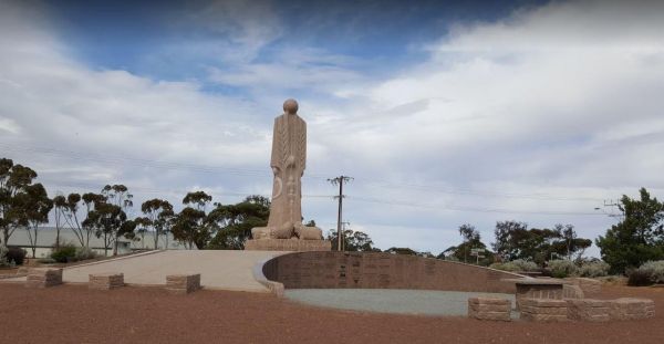
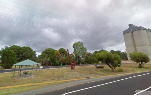
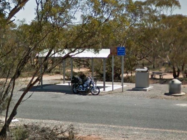
The Gawler Ranges Visitor Information Centre is in next to the Eyre Highway, with plenty of room to park your caravan. You can also walk to the Australian Farmer monument, which has a few seats, or grab a few photos of the grain silos while stopping here ...
The Geranium Rest Area is just off the Mallee Highway, with limited shade, a picnic table under some trees for shade and a rubbish bin. There is plenty of room to park your caravan here. The nearest public toilets are located at the town oval. Entrance t ...
,
The Goolwa Visitor Information Centre staff have a wealth of knowledge for the surrounding area. Its well worth a visit, but rather difficult to park next to the centre if you have a caravan attached to your vehicle. Entrance to the Goolwa Visitor Inform ...
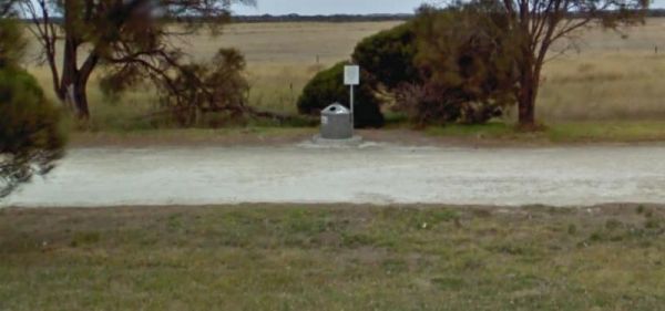
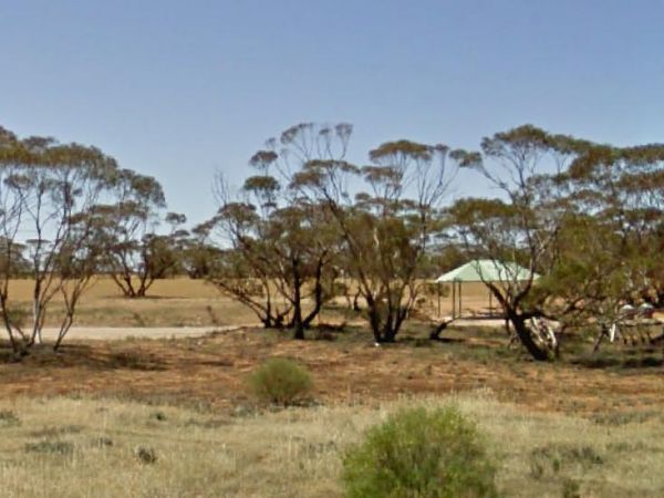
The Greenrise Lake Rest Area, water in the lake is dependent on drought conditions, and it can remain dry for years at a time, so fishing is not really an option here. Entrance to the Greenrise Lake Rest Area Greenrise Lake Rest Area location map
The Hanson Rest Area is a large gravel are which can take all sized caravans. The rest are is set back a reasonable distance from the Barrier Highway, and just off West Road. Entrance to the Hanson Rest Area Hanson Rest Area location map
,
The Haythorpe Reserve Camping Area has quite a few campsites to choose from, and you are right on the banks of the Murray River for the fishermen. Entrance to the Haythorpe Reserve Camping Area Haythorpe Reserve Camping Area location map
The Hogwash Bend Conservation Park can get very congested at times. This is a beautiful spot located on the Murray River, but expect Motor Boats, Jet Skis, and loud music if you go during the holiday season. Please take your rubbish with you when you leav ...
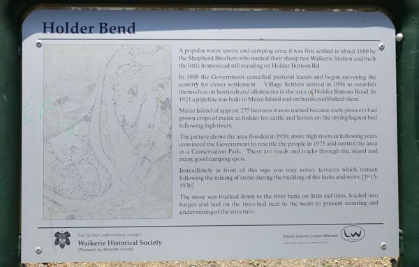
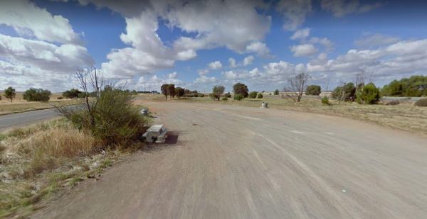
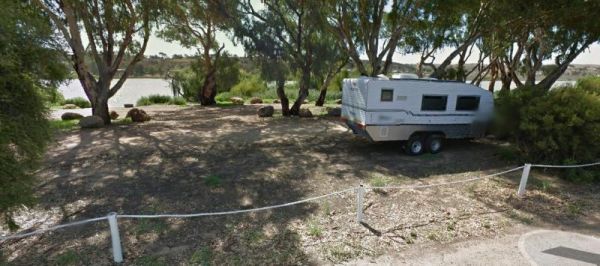
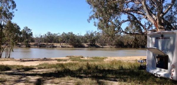
The Holder Bend Reserve and Boat Ramp is located right on Murray River, all the Campsites have no amenities, so its best suited to self contained campers. There are plenty of shaded spots to camp under, and a dump point in town to empty the necessities. ...
The James Ainsworth Horrock Monument Rest Area is set back behind a small stand of trees that offer some shade. This rest area has a picnic table and a monument to James Ainsworth Horrock who was accidentally shot by a kneeling camel while on an expeditio ...
,
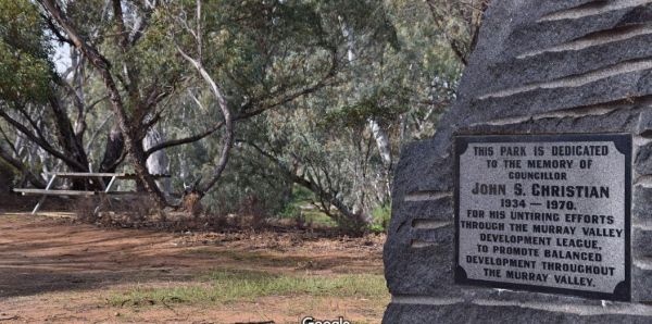
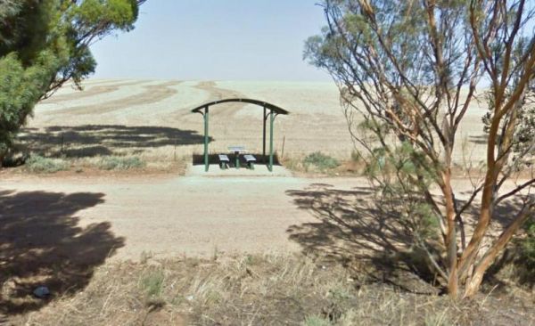
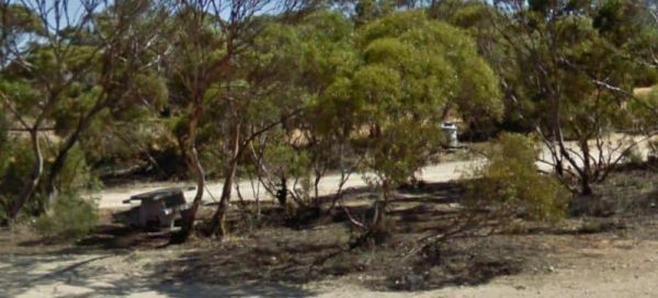
John S Christian Reserve
The John S Christian Reserve is is just off Black Hill Road. There are drop toilets and plenty of shade here with reasonably level ground, but not much else. Even though the Marne River is nearby, it will most likely be a dry river bed, so don't bother to ...
The Karoonda East Rest Area Entrance to the Karoonda East Rest Area Karoonda East Rest Area location map
,
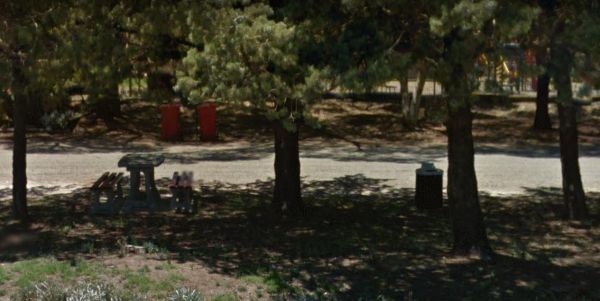
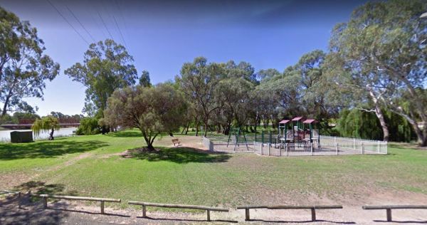
The Keith Park Rest Area has dedicated parking for caravans in Heritage Street. There is a children's playground, a BBQ, plenty of picnic tables and a few rubbish bins, plus a public toilet. Entrance to the Keith Park Rest Area Keith Park Rest Area lo ...
, , , , , ,
The Ki Ki South Rest Area is next to the Dukes Highway on asphalt. There are picnic tables and rubbish bins here, plus shome shade, and a few trees separate this rest area from the highway to give a small amount of privacy. Entrance to the Ki Ki South Re ...
,
The Kimba Rest Area has a carpark off the Cowell-Kimba Road. A public toilet and a few picnic tables, some shade, and an IGA supermarket across the road, so its a good spot to take a break from driving, and stock up on some supplies for your larder and fr ...
, , , ,
The Kingston South Rest Area is a gravel area set back from the Princes Highway. There is plenty of room to park your caravan, with lots of shade and picnic tables, and rubbish bins. Entrance to the Kingston South Rest Area Kingston South Rest Area lo ...
,
Kroehns Landing
The Kroehns Landing is located on the banks of the Murray River, to the access road can be a bit bumpy, but well worth the effort to find a nice campsite to try your hand at fishing, or wetting the bottom of your Kayak. Entrance to the Kroehns Landing ...
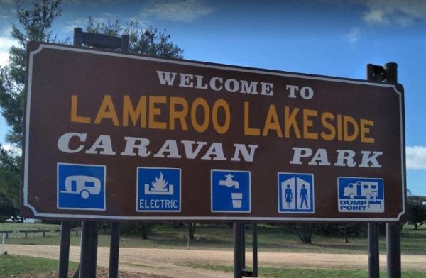
Entrance to the Lameroo Lakeside Caravan Park Lameroo Lakeside Caravan Park location map
, , , ,  , ,
, ,
Loch Luna Game Reserve Camping Area
The Loch Luna Game Reserve Camping Area has many campsites located throughout the reserve. Loch Luna Game Reserve Camping Area location map
,
The Lochiel South Rest Area is set back from the Princes Highway with a few large trees offering some shade, overlooking Lake Bumbunga. The gravel surface is reasonably level and there is an undercover picnic table and rubbish bins here also. Entrance to ...
,
Entrance to the Louth Bay Campground Louth Bay Campground location map
The Lyrup Turn Off Rest Area Entrance to the Lyrup Turn Off Rest Area Lyrup Turn Off Rest Area location map
,
The Mallala Camping Ground is a free camping ground with Hot showers that are coin operated. Campsites are good value at $10.00 per night.You are quite close to town here, and you get will your pantry from the IGA, and have a break from cooking, by headin ...
, , , ,
The Martin's Bend Reserve Campground has plenty of camping sites. Note: Direct Riverside Bank Camping is not permitted, there are dedicated campsites, at reasonable prices. Entrance to the Martin's Bend Reserve Campground Martin's Bend Reserve Campgro ...
McLaren Vale and Fleurieu Visitor Centre
The McLaren Vale and Fleurieu Visitor Centre has a bit going for it including an art gallery, cafe and wine tasting, clean toilets, indoor and outdoor seating, good parking for caravans, motorhomes and buses. Open 7 days a week (excluding Good Friday and ...
,
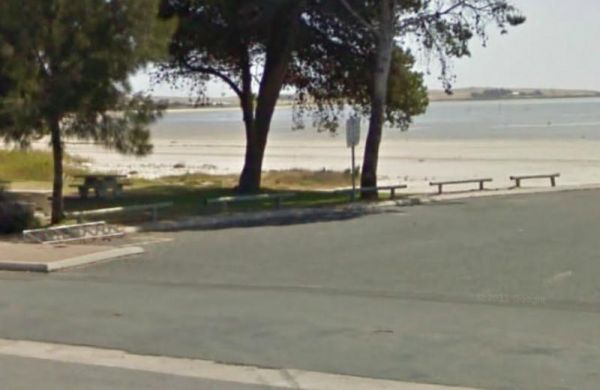
The Meningie Lions Jubilee Park has some shops within walking distance from here. You can try some beach fishing or from the small jetty at high tide. Or simply take a nice walk along the sandy shoreline. Entrance to the Meningie Lions Jubilee Park Me ...
, , ,
The Merriton North Rest Area runs alongside the Augusta Highway for quite some distance, with plenty of room for all sized rigs. There are rubbish bins and undercover picnic tables, and a bit of shade, and being close to a main highway some traffic noise. ...
,
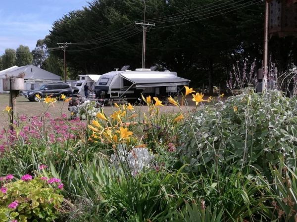
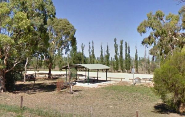
The Millicent AH&P Showground RV Camping is just off the Adelaide Road with good facilities for the price. The main shopping centre of town is only a minute or so away, with all the basic needs catered for. An added bonus are the volunteers from the S ...
, , , ,
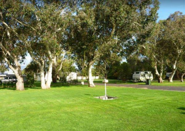
The Millicent Lakeside Caravan Park Entrance to the Millicent Lakeside Caravan Park Millicent Lakeside Caravan Park location map
, ,  , ,
, ,  , , , , ,
The Millicent North Rest Area is a nice shaded area just off the Princes Highway, with picnic tables and rubbish bins. There is plenty of room to park all sized caravans on a reasonably flat surface. Entrance to the Millicent North Rest Area Millicent ...
,
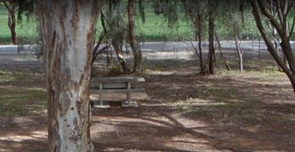
The Morambro Creek Rest Area is set back from the Riddoch Highway amongst some shady trees and picnic tables. The Morambro Creek runs along this rest spot, but no guarantee there will be any water in it. Entrance to the Morambro Creek Rest Area Moramb ...
,
Morgan Road Rest Area
The Morgan Road Rest Area is back from the Goyder Highway on reasonably level ground. There is plenty of shade, a picnic table and a few rubbish bins. Entrance to the Morgan Road Rest Area Morgan Road Rest Area location map
,
Mount Bryan Rest Area
The Mount Bryan Rest Area is opposite the Mount Bryan Hotel, and the General Store, with public toilets, rubbish bins, and picnic table under some shady trees and BBQ's. There is plenty of room to park even the largest of motorhomes, and caravans. Overall ...
, , ,
The Mt Bryan Rest Area is just off the Barrier Highway on a gravel surface. There is plenty of room to park your caravan or motorhome, there is some shade, rubbish bins and BBQ, all directly across the road from the Hotel. Entrance to the Mt Bryan Rest A ...
, , ,
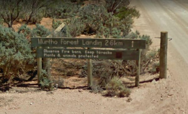
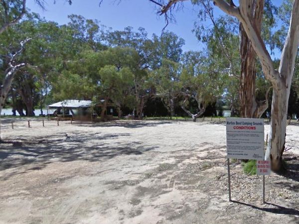
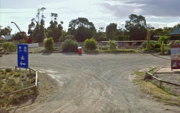
The Murtho Forest Landing Campground has quite a few camping spots very close to the Murray River. Grab your fishing line and see how you go, or drop your kayak in the water for a short exploration paddle. Entrance to the Murtho Forest Landing Campground ...
The Nooltana Creek Rest Area is slightly elevated from the Barndioota Road which runs below it. There are a few trees for shade and a rubbish bin. You can expect a few truck's to stop here, but there is plenty of room for your motorhome or caravan, and yo ...
,
North Tent Hill Rest Area
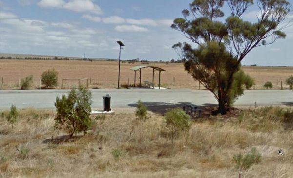
The North Tent Hill Rest Area is a large gravel level area just off the Stuart Highway with plenty of room to park your caravan. Shade is fairly limited with one covered picnic table, and a few rubbish bins spread along the rest area. Entrance to the Nor ...
,
The Orroroo Rest Area runs next to the Wilmington-Orroroo Road with a few trees for shade, rubbish bins, and picnic tables, this is another rest area to pull over when your tired from driving.campervans easily. Entrance to the Orroroo Rest Area Orroro ...
,
The Padthaway North Rest Area is a gravel road that runs parallel to the Riddoch Highway. There are low trees for shade, and undercover picnic tables, plus some rubbish bins located here. and most of this rest area, is quite flat to park on. Entrance to ...
,
The Padthaway Park Rest Area has quite a bit of room to park. There is a public toilet, some rubbish bins, and a children's playground. You can also drop into the Padthaway General Store for some supplies, and even grab some fuel before continuing on your ...
, , ,
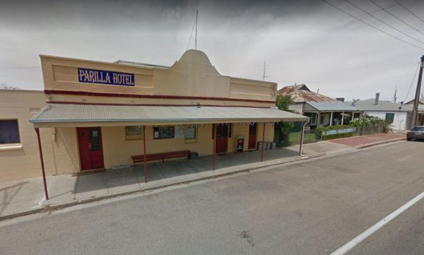
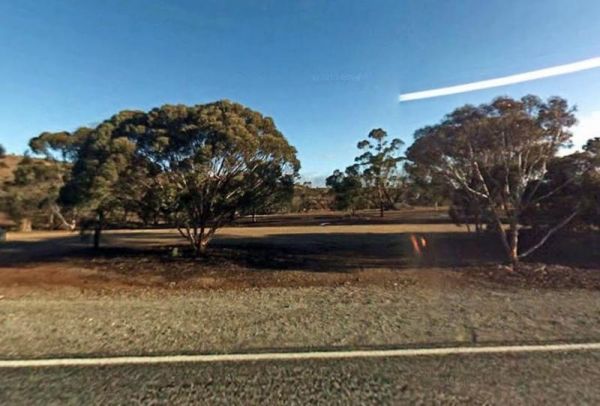
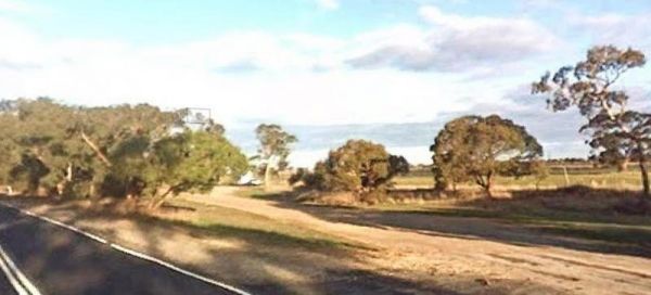
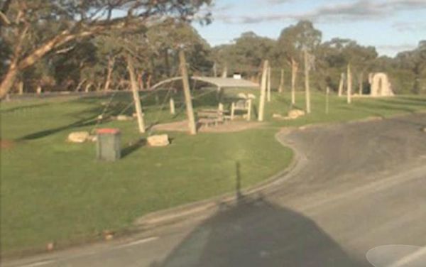
The Parilla Rest Area is in the Parilla township just off the Mallee Highway. There are undercover picnic tables, a few rubbish bins, and public toilets, the Parilla Hotel is directly opposite this rest area. Entrance to the Parilla Rest Area Parilla ...
, ,
The Parrakie Rest Area Entrance to the Parrakie Rest Area Parrakie Rest Area location map
,
The Peake Rest Area Take a break from giving and walk over to the Silos and take a photo, this rest area has Rubbish bins provided. You can also walk to the Overlander Tavern and grab a bite to eat. Entrance to the Peake Rest Area Peake Rest Area loca ...
,
Peterborough Rest Area
The Peterborough Rest Area is wedged between Peterborough Road and McNamara Road. The rest area has some shady trees to park under, picnic tables, and rubbish bins, plus plenty of room to park your caravan or motorhome. Entrance to the Peterborough Rest ...
,
Police Heritage Monument Rest Area
The Police Heritage Monument Rest Area is reasonably level but not much between you and the Sturt Highway to stop traffic noise. There is also a gravel parking area on the opposite side of the Sturt Highway for those heading in the opposite direction. En ...
,
Poocher Swamp Game Reserve
The Poocher Swamp Game Reserve while you're here why not pop into Glenda Rowett's Art Gallery, it's only 300 metres away, on the right hand side heading towards Bordertown. Entrance to the Poocher Swamp Game Reserve Poocher Swamp Game Reserve location ...
,
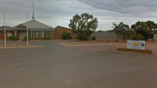
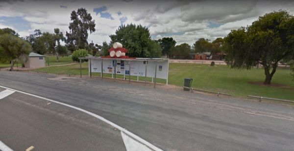
Port Augusta Tourist Information Centre
The Port Augusta Tourist Information Centre has information for the tourist visiting the area. Entrance to the Port Augusta Tourist Information Centre Port Augusta Tourist Information Centre location map
,
Port Gibbon Camping Area
The Port Gibbon Camping Area is off Beach Road with picnic tables, rubbish bins, water, and a dump point, there is a maximum camping stay of 14 nights at a time. Entrance to the Port Gibbon Camping Area Port Gibbon Camping Area location map
, , , , , , , ,
Port Kenny Park Rest Area
The Port Kenny Park Rest Area has a children's playground to keep the little one's happy. And the Port Kenny Hotel across the road to keep the biggins happy. Entrance to the Port Kenny Park Rest Area Port Kenny Park Rest Area location map
, ,
The Port Neill South Rest Area is just off the Lincoln Highway on a gravel road, with some shade, picnic tables and a rubbish bin. Entrance to the Port Neill South Rest Area Port Neil South Rest Area location map
,
The Port Parham Foreshore Camping Reserve is a wonderful free camp close to the water, and it's a great crabbing area, but be prepared to walk a fair way at low tide to catch your blue swimmer crabs. There are BBQ's, and taps with Potable water throug ...
, , , ,
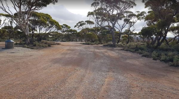
The Puntabie East Rest Area is a fairly level gravel area just off the Eyre Highway with some small trees for shade. There are picnic tables and some rubbish bins, and a few tracks leading further away from the highway for the more adventurous out there. ...
,
The Ramco Point Camping Area Entrance to the Ramco Point Camping Area Ramco Point Camping Area location map
Reedy Creek South Rest Area
The Reedy Creek South Rest Area is a small oasis of trees on the side of the Princes Highway, offering some shade from the sun and a place to rest a while, before heading off to your next oasis. Entrance to the Reedy Creek South Rest Area Reedy Creek ...
,
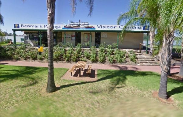
The Renmark Paringa Visitor Information Centre is the place to go to find out about the local history and current events around the towns, and to book a steam boat cruise, and they offer Free tea and coffee for patrons. Entrance to the Renmark Paringa Vi ...
, , ,
The Riverton South Rest Area runs for quite a long way parallel to the Barrier Highway . There is plenty of shady spots to stop under, and picnic tables between the rest area and the main road. Entrance to the Riverton South Rest Area Riverton South R ...
Saddleworth Rest Area
The Saddleworth Rest Area Reasonably level ground located just off the Barrier Highway, and backs onto the Gilbert River, which may or may not have any water in it. overall its an OK spot for a BBQ or Picnic. Entrance to the Saddleworth Rest Area Sadd ...
The Sandleton Fruit Fly Rest Area has plenty of room to park your caravan and motorhome. This rest spot is just off the Sturt Highway, with lots of small trees, picnic tables and rubbish bins. Entrance to the Sandleton Fruit Fly Rest Area Sandleton Fr ...
,
The Springs Road Rest Area is on the edge of the Southern Ports Highway. This rest spot has a picnic table, rubbish bin, and a bit of shade, plus its a reasonably level area to pop the van on. Lake Eliza is approx 900 metres, and there is a walking track ...
,
The Stockwell Rest Area is a small loop gravel driveway just off the Sturt Highway. There is room to park any sized rig here, but ground is not level, you will also find a rubbish bin and some limited shade, but not much else. Entrance to the Stockwell R ...
,
Stockyard Plain Rest Area
The Stockyard Plain Rest Area is a slightly elevated rest spot running alongside the Sturt Highway. Shade is very limited, but there is an undercover picnic table and rubbish bins, and reasonably level ground to park your caravan. Entrance to the Stockya ...
,
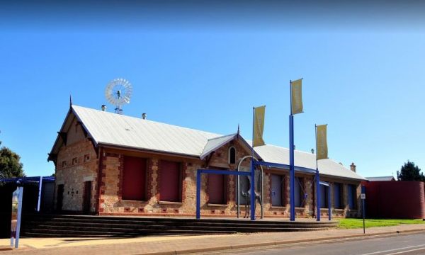
Strathalbyn Visitor Information Centre
The Strathalbyn Visitor Information Centre is located in the old Railway Station. There is plenty of room to park your caravan, and the kids can play on the playground while you get some information about the Strathalbyn area. There is a market on Saturda ...
, , ,
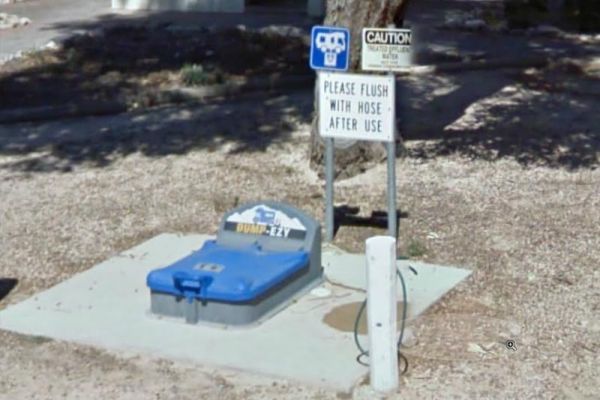
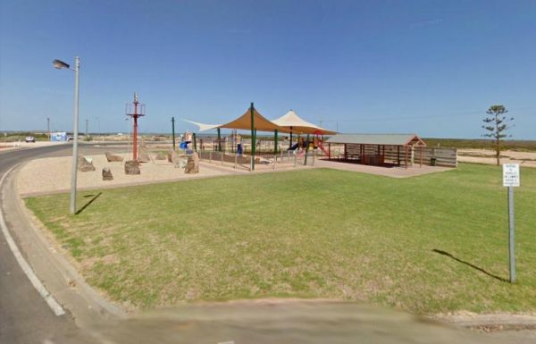
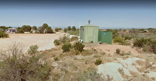
Streaky Bay Park Free Dump Point
The Streaky Bay Park Free Dump Point has plenty of room to park your motorhome or caravan next to the Dump Point. There are public toilets, undercover picnic tables and BBQ's, and some rubbish bins and a children's playground to keep you busy for a minute ...
, , , , ,
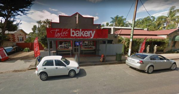
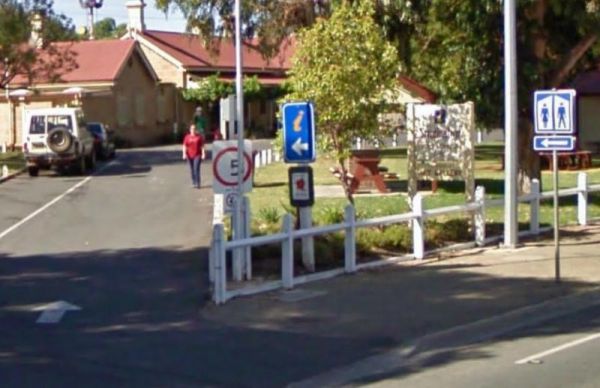
The Tarlee Park Rest Area is off the Main North Road, with plenty of room to park all sized vehicles. There is a public toilet and picnic table and rubbish bins. If you stop here why not pop over the road to the local bakery. Entrance to the Tarlee Park ...
, ,
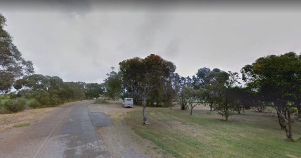
The Tarlee Rest Area is set back from the Main North Road on a stretch of asphalt from the Old Gilbert Bridge, with a few trees for shade, and nothing else, but it is a level road with room to park your caravan. Entrance to the Tarlee Park Rest Area T ...
,
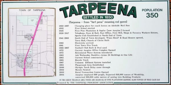
The Tarpeena Margaret Medhurst Memorial Park Rest Area is located next to the Tarpeena Memorial Hall. There is electric BBQ's, Picnic tables, public toilets, and fresh water taps, and a skate park. Entrance to the Tarpeena Margaret Medhurst Memorial Park ...
, , , ,
Tenbury Hunter Reserve
The Tenbury Hunter Reserve camping area is right next to the Murray River. Here you will find a flushing public toilet, a dump point, and some rubbish bins. Shade is limited and first in gets the spot, this is a very popular campground with fishing right ...
The Bert Dix Memorial Park Area is lovely spot on the Murray River. You have BBQ''s, picnic tables a few rubbish bins, and a nice childrens playground. There is plenty of room to turn around with your caravan, this is a really nice place to spend a n hour ...
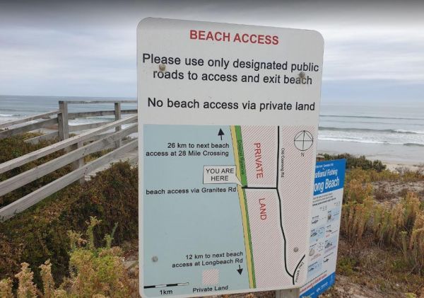
The Granites Parking Area has been revamped with a larger area for camping. From here you can drive on the beach and drive along the beach for 12k to Longbeach Road, or 26k in the other direction to the 28 Mile Crossing beach exit area. Be sure to keep an ...
, ,
The Thiele's Sandbar Camping Area You can camp on the sandbar, But I Wouldn't take a caravan there. Better to keep back a bit in the scrub if you have a van. Thiele's Sandbar Camping Area location map
The TM Price Rotary Park Rest Area is just off the Sturt Highway with off-road parking on the other side of the reserve for self contained motorhomes, there is a 24 Hour Limit imposed and No Caravans permitted. Entrance to the TM Price Rotary Park Rest A ...
, , , ,
Urimbirra Wildlife Park
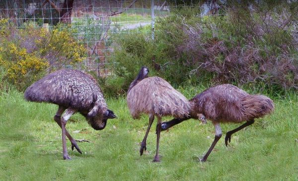
Urimbirra Wildlife Park has over 70 species of Australian fauna in their natural surroundings. This park is situated on 16 hectares, and includes freshwater and saltwater crocodiles, venomous snakes, pythons, lizards ets. Urimbirra Wildlife Park Rest Are ...
,
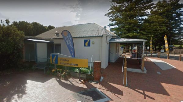
Victor Harbor Visitor Information Centre
The Victor Harbor Visitor Information Centre has lots of handy information. Be sure to book a Ride the Horse Drawn Tram across to Granite Island. Note: Parking Tickets apply, so be aware that the council will fine you if you don't have a current ticket di ...
, ,
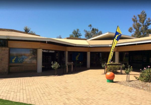
The Waikerie District Visitor Information Centre is located at Strangman Road and is the ideal first stop for all visitors passing through or to the Riverland. Comprehensive Local and Riverland tourist Information, maps, brochures are available as well as ...
The Wangary Rest Area is reasonable level and just off the Flinders Highway, pop in and have a picnic at the undercover picnic table area. Entrance to the Wangary Rest Area Wangary Rest Area location map
,
The Wauraltee Beach Camping Area has a few sheltered campsites amongst the sand dunes. Make sure you obtain a permit first, if you want to stay here. Entrance to the Wauraltee Beach Camping Area Wauraltee Beach Camping Area location map
, ,

Willalooka Park Rest Area
The Willalooka Park Rest Area is set back from the Riddoch Highway, with a public toilet, some rubbish bins, and picnic tables. This rest spot is in front of the Riddoch Hall, and its a short walk to the Willalooka Tavern for those so inclined. Entrance ...
, , , ,
The Winavon Rest Area is a gravel strip running alongside the Riddoch Highway. There is some shade, rubbish bins and an undercover picnic table, and plenty of room to park your caravan. Entrance to the Winavon Rest Area Winavon Rest Area location map ...
,
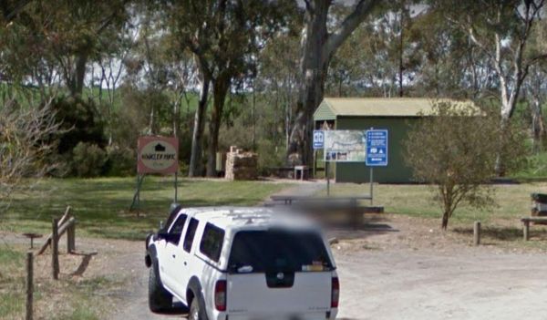
Winkler Park Rest Area
The Winkler Park Rest Area is just off the Barrier Highway, and backs onto the Gilbert River, there are toilets, and a few picnic tables. There is also a sign pointing to where you can park your caravan. Entrance to the Winkler Park Rest Area Winkler ...
The Yamba East Rest Area is on both sides of the Sturt Highway, there some rubbish bins and small shade trees. There is quite a lot of room to park your caravan or motorhome Entrance to the Yamba East Rest Area Yamba East Rest Area location map
,
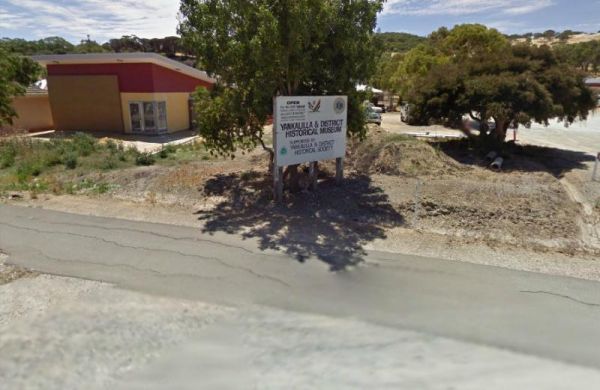
Yankalilla Bay Visitor Information Centre
The Yankalilla Bay Visitor Information Centre has a lot going for it, and the museum is a real gem. It features some historical machinery and equipment, plus some of the early pioneer furniture. Entrance to the Yankalilla Bay Visitor Information Centre ...
,