Facilities Available: Fishing
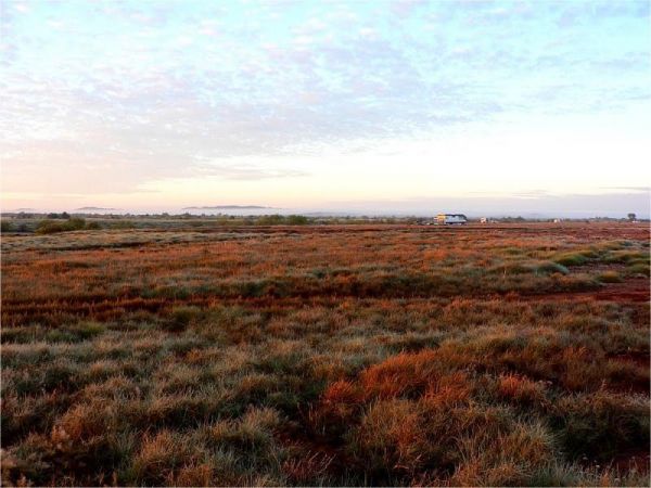
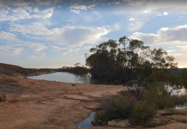
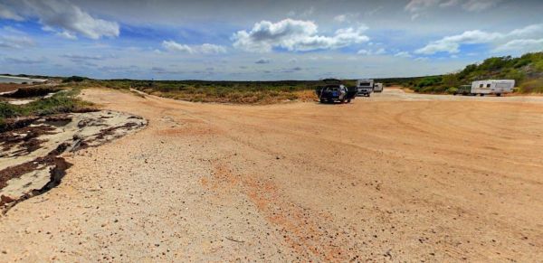
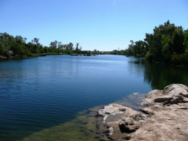
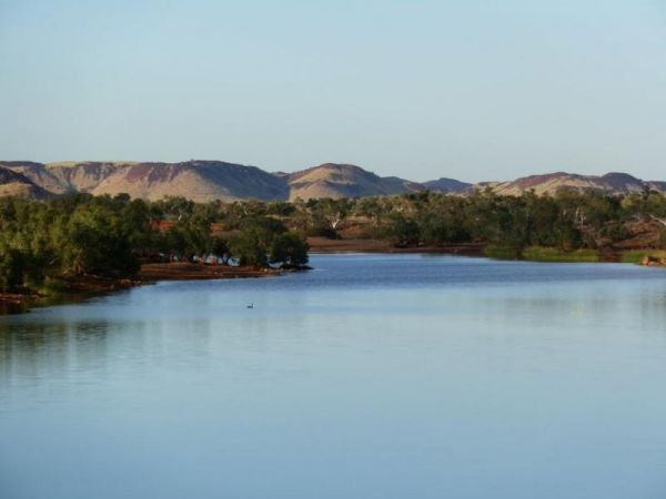
Balla Balla Inlet
The Balla Balla Inlet is just off Balla Balla Road, with lots of open space to camp, and plenty of places to stop all along the inlet. Balla Balla Inlet location map
 ,
, 
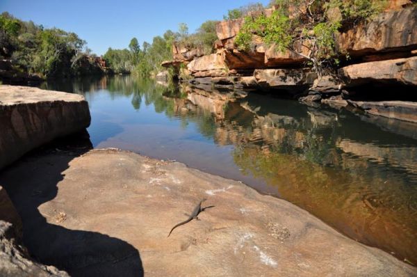
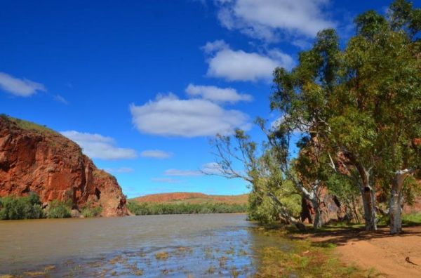
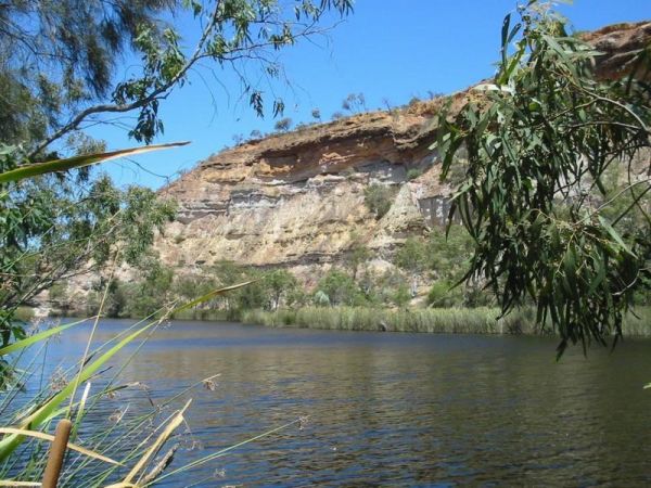
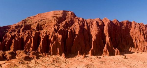
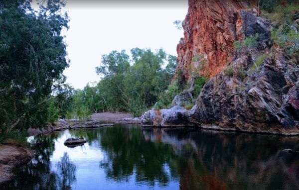
The Barnett River Gorge Barnett River Gorge location map
 , ,
, ,
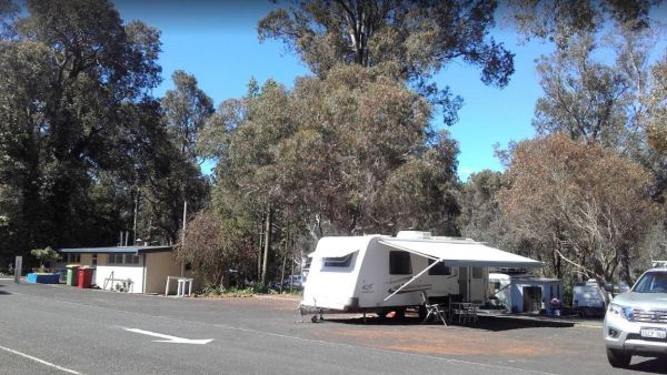
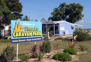
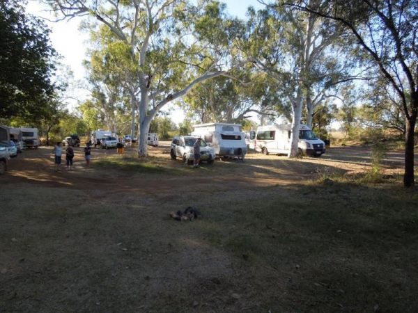
Bridgetown Caravan Park
Entrance to the Bridgetown Caravan Park Bridgetown Caravan Park location amp
 ,
,  , ,
, ,  , ,
, ,  ,
,
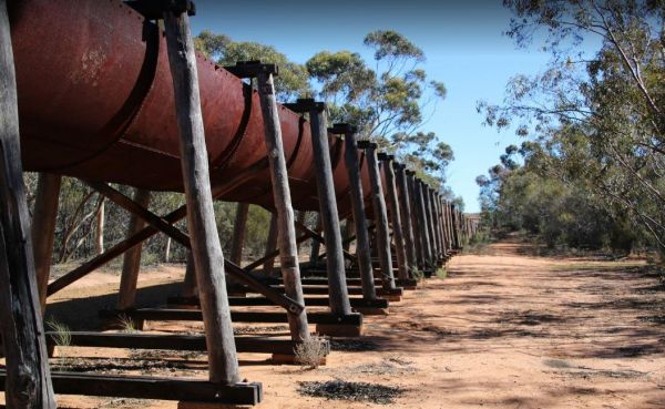
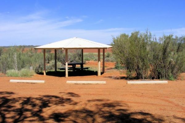
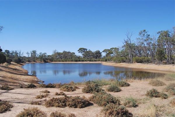
The Bromus Dam Camping Area is set back a short distance from the Coolgardie-Esperance Highway. There are quite a few shaded campsites available, and the chance of a yabbie dinner. Entrance to the Bromus Dam Camping Area Bromus Dam Camping Area locati ...
, ,
Burra Rock Nature Reserve Camping Area
The Burra Rock Nature Reserve Camping Area at the base of the rock is a dam once used to water the steam trains used for carting wood back to kalgoorlie & coolgardie for fuel. There is a campsite, picnic tables and a toilet for visitors. Burra Rock N ...
, ,  ,
,
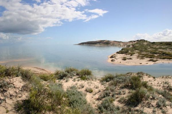
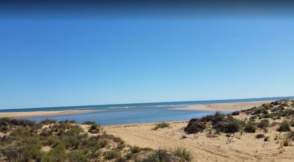
The Bush Bay Camping Area, is very close to the ocean, and is no longer a free camp. There is a Dump point, but no toilet facilities here.Also note: The Shire of Carnarvon are now charging an overnight camping fee to stay here. Bush Bay Camping Area loca ...
, ,  ,
,
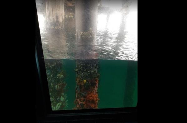
The Busselton Underwater Observatory is at the end of a long jetty. You can either walk its length or take the train. Once you arrive at the Underwater Observatory, you will need to walkdown 9 metres to the sea floor, once there you will see lots of marin ...
,
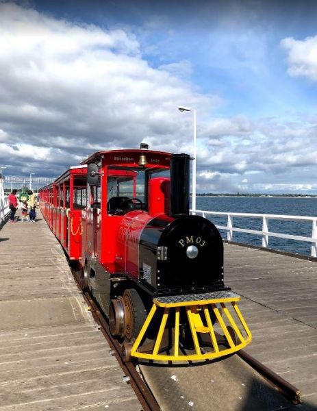
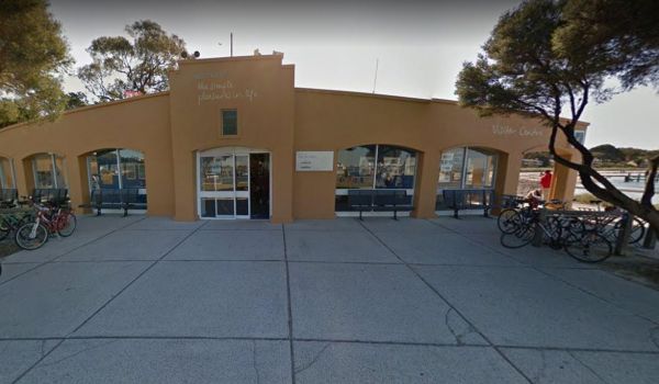
The Busselton Visitor Information Centre has lots to offer. Be sure to grab a train ride on the Busselton Jetty, the jetty is approx 1.8km long, so its a long walk if you prefer, and once you get to the end, you will come across the Underwater Observatory ...
,
Cliff Head North Rest Area
The Cliff Head North Rest Area has had a few of the tracks closed due to soft sand and 2wd vehicles towing caravans. Entrance to the Cliff Head North Rest Area Cliff Head North Rest Area location map
, ,
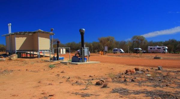
Coongan Pool
The Coongan Pool is on a dry weather weather road, the camping area has limited shade and no facilities, and is well away from the main road, you can easily miss the turn, Coongan Pool location map
, ,
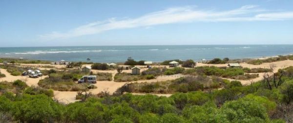
Coronation Beach Campground
The Coronation Beach Campground is one of the most attractive and popular beaches along the Mid West Coast with both locals and visitors alike. It is considered to be one of the finest windsurfing locations in the world, and outside the windsurfing season ...
,  , , , ,
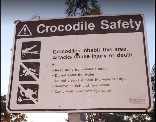
The De Grey River Rest Area has a 24 Hour Limit it also has flushing clean toilets and there is plenty of room to park away from the highway. Warning: Crocodiles have been reportedly seen in the river so take care. Entrance to the De Grey River Rest Area ...
, , , , 
Dooleena Gorge Camping Area
The Dooleena Gorge Camping Area is approx 41 kilometres north of Marble Bar on the Marble Bar-Port Hedland Road. The turnoff is very easy to miss, and it's a bit narrow in places. Once your there you will find lots of wildlife and photo opportunities. Fis ...
, ,
The Eadine Springs Rest Area turnoff is easy to miss, but once your here there is shade, BBQ's and some undercover picnic tables and rubbish bins. Entrance to the Eadine Springs Rest Area Eadine Springs Rest Area location map
, , , , ,
The Eagle Bluff Campsite has a 24 Hour Limit, you must Register if you want to stay at this location, as there are only 4 campsites sites available. Entrance to the Eagle Bluff Campsite Eagle Bluff Rest Area location map
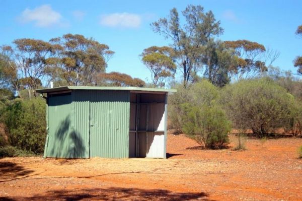
The Ellendale Pool Camping Area has flushing toilets a Gas BBQ, Rubbish Bins a shaded seating area. Swimming is not advised as the lack of flowing water can make the pool stagnant. There is a small camping fee to camp here, and a maximum 7 Day Limit Entr ...
, , , , , ,
The Galena Bridge Rest Area is a 24 Hour stop over, with public toilets and picnic tables. There is plenty of level ground to park your caravan on, also a few rubbish bins onsite. NOTE: No campfires permitted between 15 October to 1 March. Entrance to th ...
, , , ,
The Geraldton Visitor Information Centre Open Hours: Monday to Friday 9am-5pm Saturday - Sunday 9am-1pm Entrance to the Geraldton Visitor Information Centre Geraldton Visitor Information Centre location map
, ,
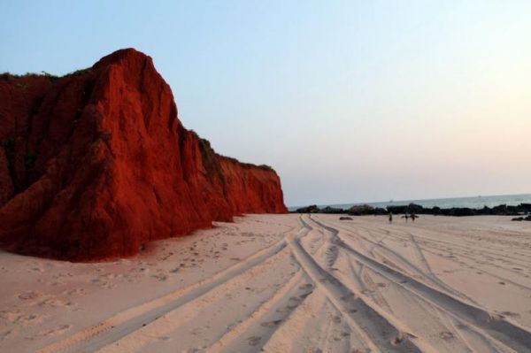
The James Price Point Camping Area has plenty of places to choose from. Access to the beach via 4x4 can be a bit tricky, and it has been reported getting off the beach an be a bit difficult. Entrance to the James Price Point Camping Area James Price Poi ...
,
Karalee Rocks Camping Area
The Karalee Rocks Camping Area has a 72 Hour Limit to stop here. This site has flushing toilets. Lots of shaded areas. Great swimming in the dam and you can catch yabbies in there for dinner if you like. Entrance to the Karalee Rocks Camping Area Kara ...
, , , , ,
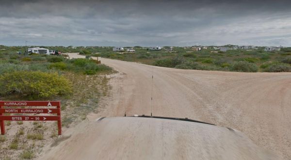
The Kurrajong (Cape Range) Campground must be booked in advance if you intend to stay here. If your lucky you might see a whale shark swimming by the coastline. Entrance to the Kurrajong (Cape Range) Campground Kurrajong (Cape Range) Campground locati ...
,
The Lake Douglas Recreation Reserve has a Drop toilet with lots of walking trails, only 3 overnight stays, rangers patrol area. There are rubbish bins, picnic tables, the fire pits have free firewood supplied by the rangers. Entrance to the Lake Douglas ...
, , , , , ,
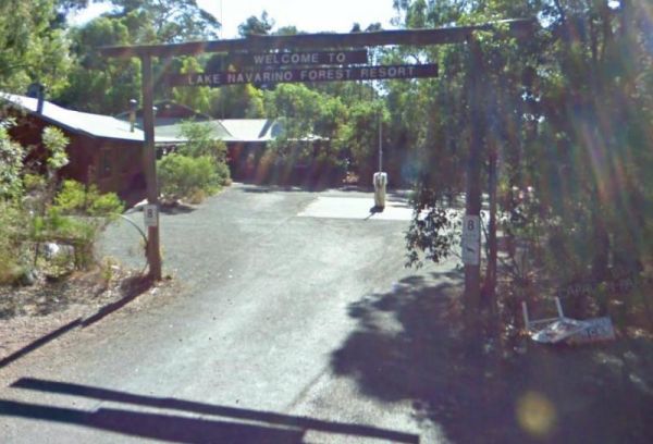
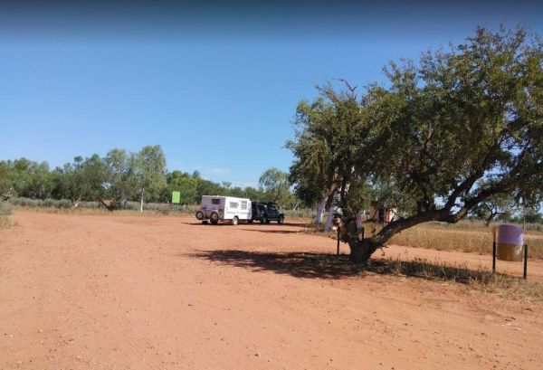
The Lake Navarino Holiday Park has fire pits, plenty of trees for shade. The camp kitchen is decent but pretty small. Entrance to the Lake Navarino Holiday Park Lake Navarino Holiday Park location map
, ,  , , , ,
  ,
,  ,
,
Lake Towerrinning Lakeside Camping
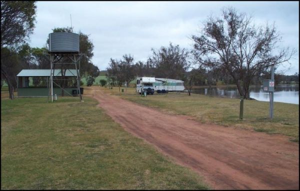
The Lake Towerrinning Lakeside Camping is lakeside, But its best to bring your own drinking water, as the water tower might be low or empty. Entrance to the Lake Towerrinning Lakeside Camping Lake Towerrinning Lakeside Camping location map
, , , , ,  ,
,
Lennard River Rest Area
The Lennard River Rest Area Approx 100 metres of the main road on the banks of the Lennard River, nice spot for a day visit. Entrance to the Lennard River Rest Area Lennard River Rest Area location map
, ,
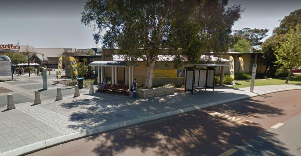
The Mandurah Visitor Information Centre is a Large visitor centre with many maps, leaflets & brochures giving comprehensive information on all parts of WA as well as Mandurah / Peel region. Entrance to the Mandurah Visitor Information Centre Mandu ...
,
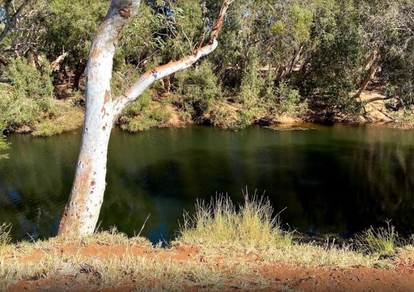
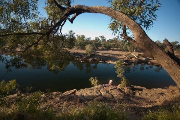
Mary Pool Rest Area
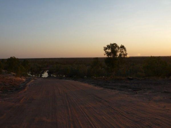
The Mary Pool Rest Area you should keep a watch for crocodiles that frequent the area, so be careful with small children and pets near the water. This is a popular camping spot, with quite a few places to chose from all on reasonably level ground. There a ...
, , , ,
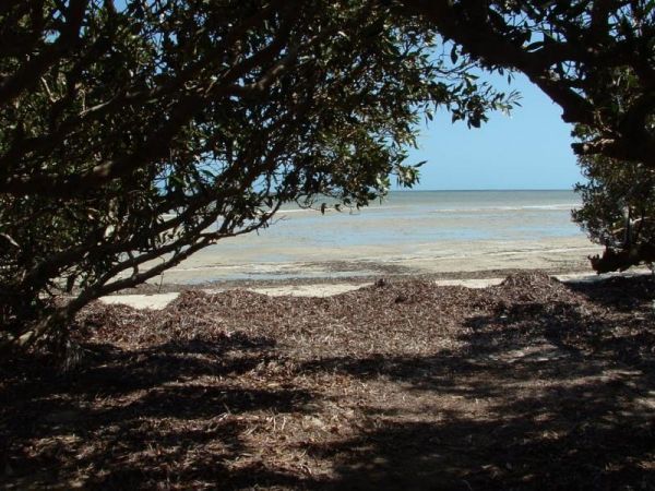
The Miaboolya Beach Rest Area is popular amongst the locals and tourists for recreational fishing, crabbing, and swimming. You will need to be self sufficient if you decide to stop here.Just a quick note, the fisheries inspectors have been known to freque ...
,
The Miaree Pool Rest Area is a short drive down a dirt road to the Nullagine River, where there is a fireplace BBQ and undercover picnic tables. Entrance to the Miaree Pool Rest Area Miaree Pool Rest Area location map
, , , , , ,
Palm Springs Rest Area
The Palm Springs Rest Area is off Duncan Road, and on the banks of the Black Elvire River for those who like fishing. Palm Springs Rest Area location map
, ,
Peak Charles National Park Camping Area
The Peak Charles National Park Camping Area access road can be very rough at times. There are dedicated fire pits, undercover picnic tables, and plenty of walking tracks. The track to the summit is not well marked, so do take care if you intend to do the ...
, , ,
The Quandong Camping Area is best suited to 4x4's and the road is quite narrow in places. But once there, you have a few different campsites to choose from. Entrance to the Quandong Camping Area Quandong Camping Area location map
,
The RAC Cervantes Holiday Park offer discounts to RACV Members. The caravan park has a fully-equipped camp kitchen a shell museum, Coffee shop and walking distance to the beach. Entrance to the RAC Cervantes Holiday Park RAC Cervantes Holiday Park loc ...
, , ,  , , , , , , ,
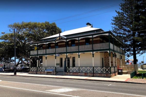
Rottnest Island Visitor Information Centre
The Rottnest Island Visitor Information Centre Entrance to the Rottnest Island Visitor Information Centre Rottnest Island Visitor Information Centre location map
, ,
The Rowles Lagoon Nature Reserve Camping Area has a public toilet and lots of fire pits, and the camping area is well maintained. You will have no trouble finding a campsite. Note: Water levels in the lake vary as to the seasons. So it might pay to check ...
, ,
The Russ Creek Camping Area is a basic camp site where you bring everything you need and take away your rubbish. make certain you have plenty of fresh water if choosing to stay here. Russ Creek Camping Area location map
, , ,
Sawpit Gorge Camping Area
The Sawpit Gorge Camping Area has a 72 Hour Limit on the banks of the Black Elvire River. This campsite is best suited to tent and vehicle based camping. Be sure to bring everything you need, and don't rely on water being present. Sawpit Gorge Camping Ar ...
, ,
The Sherlock River Rest Area has a 24 Hour Limit imposed on it. This rest area has an undercover picnic table and a fireplace, there is limited shade, and it's on the banks of the Shitloch River. Entrance to the Sherlock River Rest Area Sherlock River ...
, , ,
The Spring Creek Rest Area has a 24 hour limit for stopovers a public toilet, and a dump point. There are rubbish bins, undercover picnic tables, and level areas to park under shady gum trees next to Spring Creek. Entrance to the Spring Creek Rest Area ...
, , , , , ,
The Yardie Creek Campground has 11 campsites approximately 80 metres from the beach. You need to book in advance between April 1 and October 11. There is a nice walk along the Yardie Creek Trail, which will take you to the gorge, it's not too difficult. T ...
,
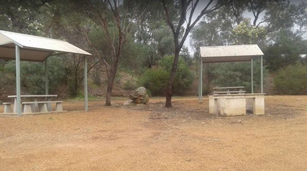
The Yornaning Dam Rest Area has BBQ's and picnic tables, with plenty of shady spots to park.No Camping Permitted. Day Rest Area Only. Entrance to the Yornaning Dam Rest Area Yornaning Dam Rest Area location map
, , , , ,