Facilities: Fishing
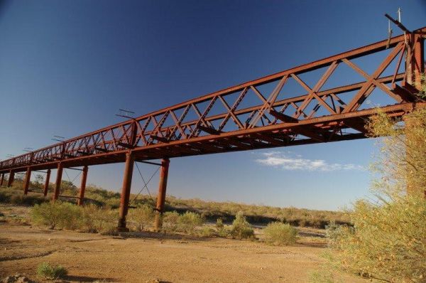
The Algebuckina Bridge is something you must stop and see if travelling the Oodnadatta Track. The Algebuckina Bridge 360 Algebuckina Bridge location map
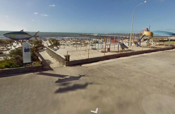
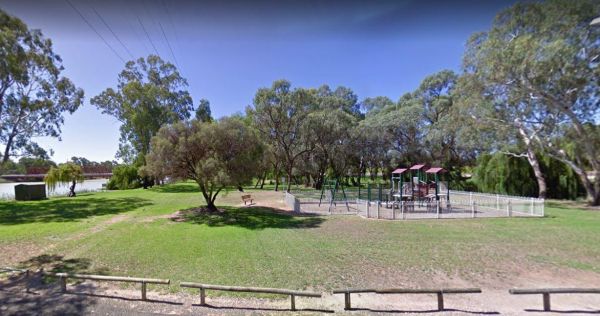
The Arno Bay Park Rest Area is next to a children's playground and a short stroll to the beach, and the town jetty. The Hotel Arno is within easy walking distance also. Entrance to the Arno Bay Park Rest Area Arno Bay Park Rest Area location map ...
 ,
,  ,
,  ,
, 

The Barkers Rocks Camping Area is nestled has an undercover picnic table and an emergency supply of water. There are a few areas to park your caravan. Entrance to the Barkers Rocks Camping Area Barkers Rocks Camping Area location map
,  ,
, 
The Barmera Apex Park Rest Area is a gravel area within easy walking distance to the Lake Bonney. The lake is quite shallow here, so it's not a bad spot to have a splash with the kids. Entrance to the Barmera Apex Park Rest Area Barmera Apex Park Rest ...
,  ,
,  , , ,
, , ,
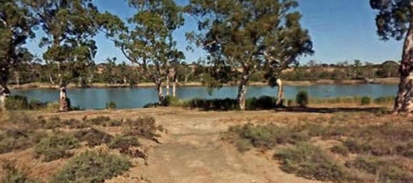
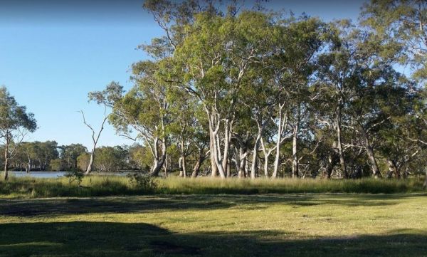
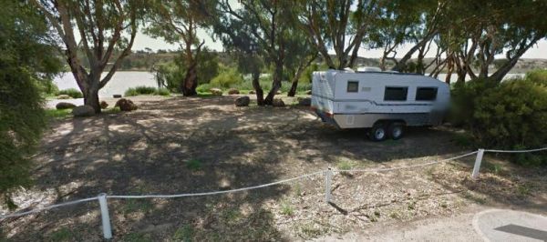
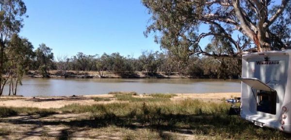
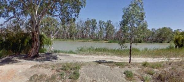
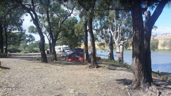
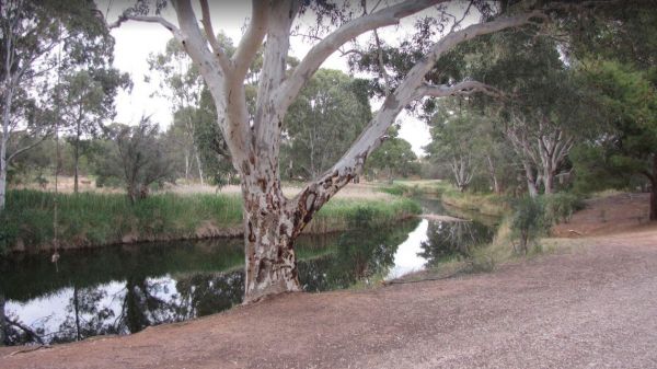
The Big Bend Camping Area is on the banks of the Murray River, there are plenty of camping spots to choose from, all with rivergums, and a waterfront view. Entrance to the Big Bend Camping Area Big Bend Camping Area location map
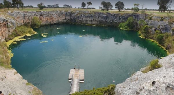
The Cockatoo Lake Reserve is a lovely bush camp with 1 flushing toilet and plenty of grassy areas to park your caravan or motorhome. There is plenty of wildlife and lots of noisy corellas roosting. Cockatoo Lake Reserve location map
, , , ,
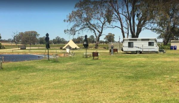
Entrance to the Coonawarra Bush Holiday Park Coonawarra Bush Holiday Park location map
, , , ,  , , ,
, , ,
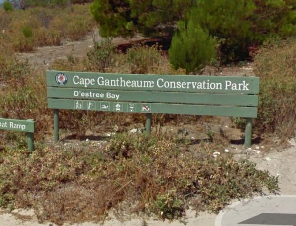
Entrance to the D'Estrees Bay Campground D'Estrees Bay Campground location map
The Freds Landing Rest Area is nestled between the Murray River and the Princes Highway. There is plenty of room to park your caravan, there are not many shade trees to park under, but there is a public toilet, picnic tables, and rubbish bins, and those i ...
,  ,
,  , , , ,
The Haythorpe Reserve Camping Area has quite a few campsites to choose from, and you are right on the banks of the Murray River for the fishermen. Entrance to the Haythorpe Reserve Camping Area Haythorpe Reserve Camping Area location map
The Heron Bend Camping Area is set alongside the Murray River with plenty of bush camps to choose from. There are a few trees on the riverbank for shelter from the sun while you try your hand at catching a fish for dinner. Entrance to the Heron Bend Camp ...
The Hettner Landing Camping Area is located on the banks of the Murray River with lots of suitable campsites available. It's a nice place to relax and take in the wildlife, you have a public toilet onsite, picnic tables, plus a few rubbish bins. You can a ...
The Hogwash Bend Conservation Park can get very congested at times. This is a beautiful spot located on the Murray River, but expect Motor Boats, Jet Skis, and loud music if you go during the holiday season. Please take your rubbish with you when you leav ...
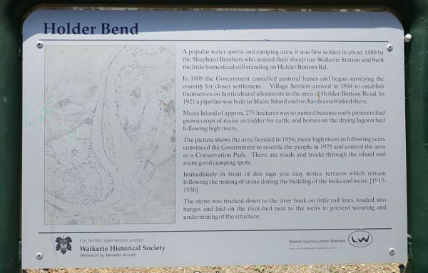
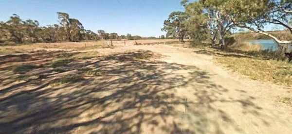
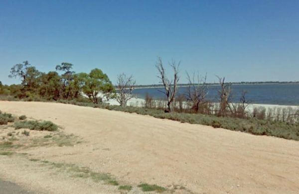
The Holder Bend Reserve and Boat Ramp is located right on Murray River, all the Campsites have no amenities, so its best suited to self contained campers. There are plenty of shaded spots to camp under, and a dump point in town to empty the necessities. ...
The Kroehns Landing is located on the banks of the Murray River, to the access road can be a bit bumpy, but well worth the effort to find a nice campsite to try your hand at fishing, or wetting the bottom of your Kayak. Entrance to the Kroehns Landing ...
The Lake Bonney Rest Area is on the shoreline of Lake Bonny, this is a nice spot to have a picnic, and it's not far from the Barmera North Lake Caravan Park. Entrance to the Lake Bonney Rest Area Lake Bonney Rest Area location map
,
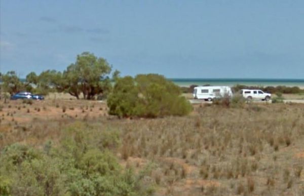
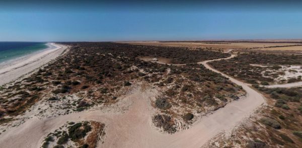
The Lipson Cove Campground is next to a nice sandy bay on the Eyre Peninsula overlooking the Spencer Gulf, you will be quite isolated here so make sure you have plenty of supplies with you. Entrance to the Lipson Cove Campground Lipson Cove Campground ...
, , ,
The Little Blue Lake Rest Area Entrance to the Little Blue Lake Rest Area Little Blue Lake Rest Area location map
,
The Loch Luna Game Reserve Camping Area 2 has a public toilet, and quite a few campsites along the Murray River. These are mainly very basic camps suited to those of you who are self contained, Dogs must be on a leash at all times. Entrance to the Loch L ...
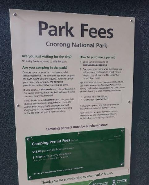
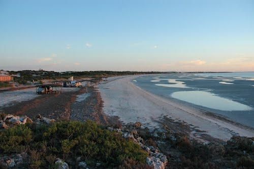
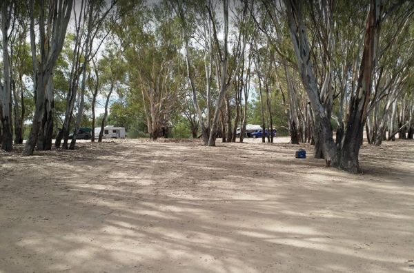
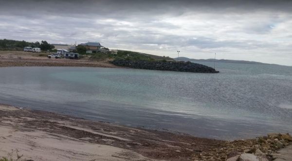
The Long Point Campground is located within the Coorong National Park. There is plenty of room for all sized caravans and motorhomes. Beautiful water views from some of the onsite picnic tables. You will also find a public toilet onsite, please remember t ...
Entrance to the Louth Bay Campground Louth Bay Campground location map
Entrance to the Mark Point Campground Mark Point Campground location map
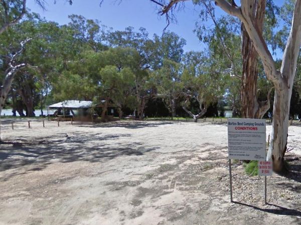
The Martin's Bend Reserve Campground has plenty of camping sites. Note: Direct Riverside Bank Camping is not permitted, there are dedicated campsites, at reasonable prices. Entrance to the Martin's Bend Reserve Campground Martin's Bend Reserve Campgro ...
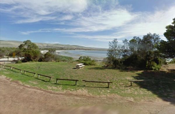
The Meningie Lions Jubilee Park has some shops within walking distance from here. You can try some beach fishing or from the small jetty at high tide. Or simply take a nice walk along the sandy shoreline. Entrance to the Meningie Lions Jubilee Park Me ...
, , ,
The Millicent Lakeside Caravan Park Entrance to the Millicent Lakeside Caravan Park Millicent Lakeside Caravan Park location map
, ,  , ,
, ,  , , , , ,
The Mount Dutton Bay Rest Area is right next to the water's edge. There is a public toilet block here, and room to park your caravan, and Please keep the boat ramp area clear at all times. Entrance to the Mount Dutton Bay Rest Area Mount Dutton Bay Re ...
, ,
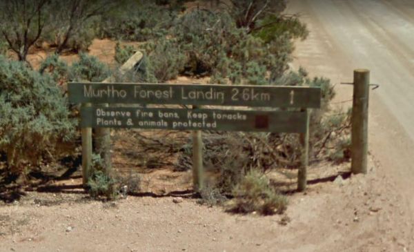
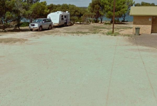
The Murtho Forest Landing Campground has quite a few camping spots very close to the Murray River. Grab your fishing line and see how you go, or drop your kayak in the water for a short exploration paddle. Entrance to the Murtho Forest Landing Campground ...
, , ,
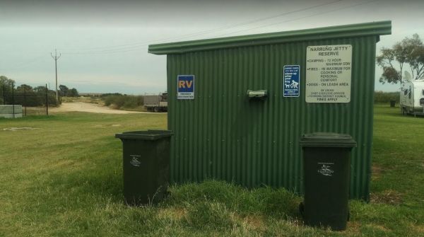
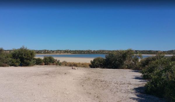
The Narrung Jetty Reserve is a beautiful free camping site grassy area. There are two toilet blocks, rubbish bins and water for washing dishes etc. NOTE: 72 Hour Limit for camping Entrance to the Narrung Jetty Reserve Narrung Jetty Reserve location ma ...
, , , ,
The Perlubie Beach Camping Area Entrance to the Perlubie Beach Camping Area Perlubie Beach Camping Area location map
,
The Plushes Bend Camping Area Quite a few shady camping spots close to the Murray River water's edge, and there is a composting public toilet onsite to make your stay a bit more pleasant. Please take your rubbish with you when you leave. Entrance to the ...
The Point Lowly Camping Area has a 14 Day Camping Limit This place has it all, great views, good fishing, clean facilities its a credit to the Whyalla Council. If you intend to pitch a tent, make sure you have heavy duty tent pegs as the ground is rock ha ...
, , , , ,
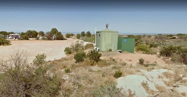
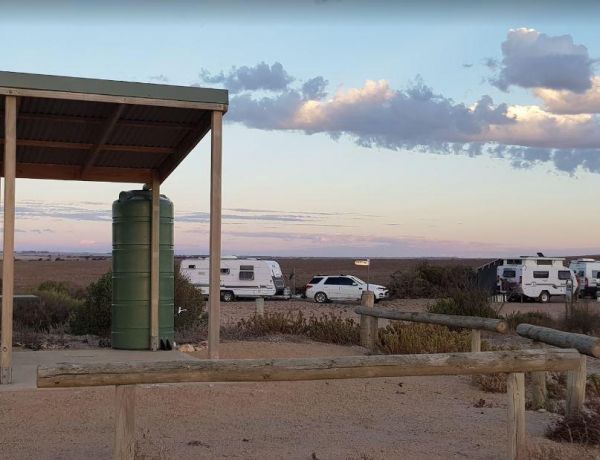
The Port Gibbon Camping Area is off Beach Road with picnic tables, rubbish bins, water, and a dump point, there is a maximum camping stay of 14 nights at a time. Entrance to the Port Gibbon Camping Area Port Gibbon Camping Area location map
, , ,  , , , , ,
The Port Minlacowie Boat Ramp is off the George Mumford Road, if you intend to stop here for an hour or so to take in the views of the Spencer Gulf. Please keep access to the boat ramp clear for the locals. Entrance to the Port Minlacowie Boat Ramp Po ...
, ,
The Port Parham Foreshore Camping Reserve is a wonderful free camp close to the water, and it's a great crabbing area, but be prepared to walk a fair way at low tide to catch your blue swimmer crabs. There are BBQ's, and taps with Potable water throughout ...
, , , ,
The Ramco Point Camping Area Entrance to the Ramco Point Camping Area Ramco Point Camping Area location map
The Red Banks Rest Area is down a bumpy dirt road, with parking for around 6 caravans, but the cliffs have been deemed unstable, so I'm not sure if camping is allowed anymore. Entrance to the Redbanks Rest Area Red Banks Rest Area location map
,
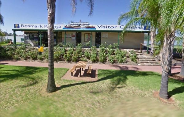
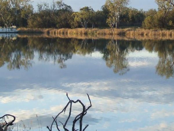
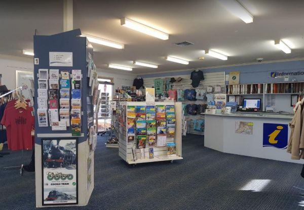
The Renmark Paringa Visitor Information Centre is the place to go to find out about the local history and current events around the towns, and to book a steam boat cruise, and they offer Free tea and coffee for patrons. Entrance to the Renmark Paringa Vi ...
, , ,
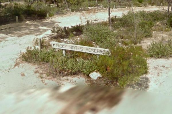
The Ricky Bates Reserve is just off Dolphin Drive on the water's edge. This spot is fairly secluded spot.Please Note: No Overnight stays permittedNOTE: There are a few low cost camp sites available not far away, my Dutton bay woolshed, Farm beach. Shelly ...
,
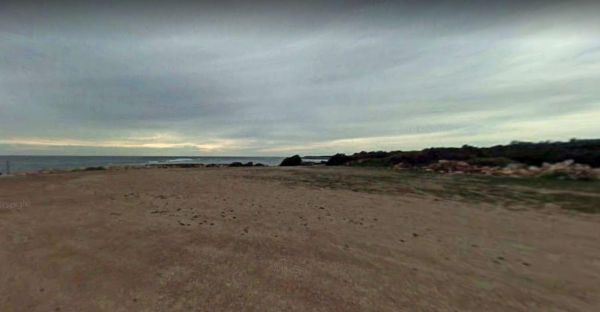
The Sheringa Beach Camping Area has a series of parking bays, each within easy walking access to beach for fishing and surfing. There is a public toilet onsite. Sheringa Beach Free Camping Area location map
,
The Tenbury Hunter Reserve camping area is right next to the Murray River. Here you will find a flushing public toilet, a dump point, and some rubbish bins. Shade is limited and first in gets the spot, this is a very popular campground with fishing right ...
The Bamboos Camping Area Not really suited for caravans but ideal for small camper trailers. Make sure you obtain a permit first. Camping permit required to camp here Entrance to The Bamboos Camping Area The Bamboos Camping Area location map
,
The Bert Dix Memorial Park Area is lovely spot on the Murray River. You have BBQ''s, picnic tables a few rubbish bins, and a nice childrens playground. There is plenty of room to turn around with your caravan, this is a really nice place to spend a n hour ...
, , , , , , , ,
The Gap Camping Area is just off Gap Road overlooking the Spencer Gulf, with room for caravans. There is an undercover picnic table and a small reserve of freshwater.Make sure you obtain a permit first as a Camping permit required if you intend to stay he ...
,
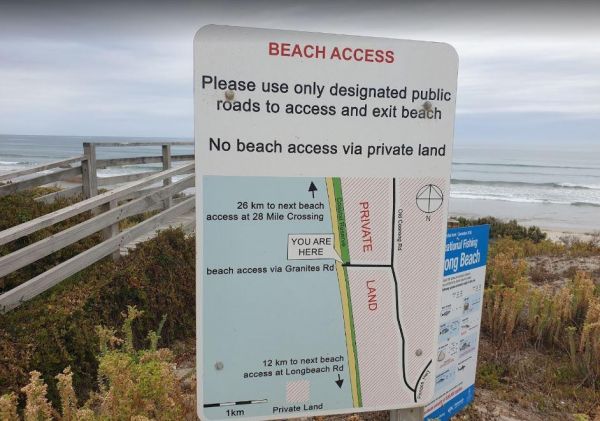
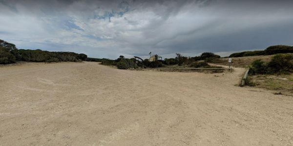
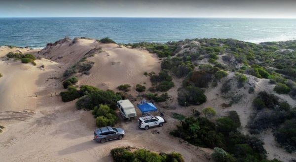
The Granites Parking Area has been revamped with a larger area for camping. From here you can drive on the beach and drive along the beach for 12k to Longbeach Road, or 26k in the other direction to the 28 Mile Crossing beach exit area. Be sure to keep an ...
, ,
The Thiele's Sandbar Camping Area You can camp on the sandbar, But I Wouldn't take a caravan there. Better to keep back a bit in the scrub if you have a van. Thiele's Sandbar Camping Area location map
The Tiparra Rocks Camping Area is a rough campsite, bring everything with you, and take your rubbish away when you leave. Make sure you obtain a permit first, if you want to stay here. Tiparra Rocks Camping Area location map
,
The Victor Harbor Visitor Information Centre has lots of handy information. Be sure to book a Ride the Horse Drawn Tram across to Granite Island. Note: Parking Tickets apply, so be aware that the council will fine you if you don't have a current ticket di ...
, ,
The Wauraltee Beach Camping Area has a few sheltered campsites amongst the sand dunes. Make sure you obtain a permit first, if you want to stay here. Entrance to the Wauraltee Beach Camping Area Wauraltee Beach Camping Area location map
, ,
The Whitecliff Reserve Camping Area is located approximately 2 km's from Koolunga and 10 km's from the township of Yackahas. There is plenty of shady trees with approximately 15 campsites along the River Broughton, and a long drop public toilet. Entrance ...